 geocatalogue.geoportail.lu
PAG>National planning data>human environment>Railroads
Type of resources
Available actions
Topics
Keywords
Contact for the resource
Provided by
Groups
Years
Representation types
Update frequencies
status
Scale
-

In accordance with European legislation, the Environment Agency has updated the strategic noise maps for the fourth cycle of Directive 2002/49/EC of the European Parliament and of the Council of 25 June 2002 relating to the assessment and management of environmental noise. These maps refer to the year 2021 and indicate, with the aid of a standardised colour scale using the Lngt indicator, the exposure to ambient noise in decibels of the major rail routes with more than 30,000 passages per year located within the territory of the Grand Duchy of Luxembourg.
-
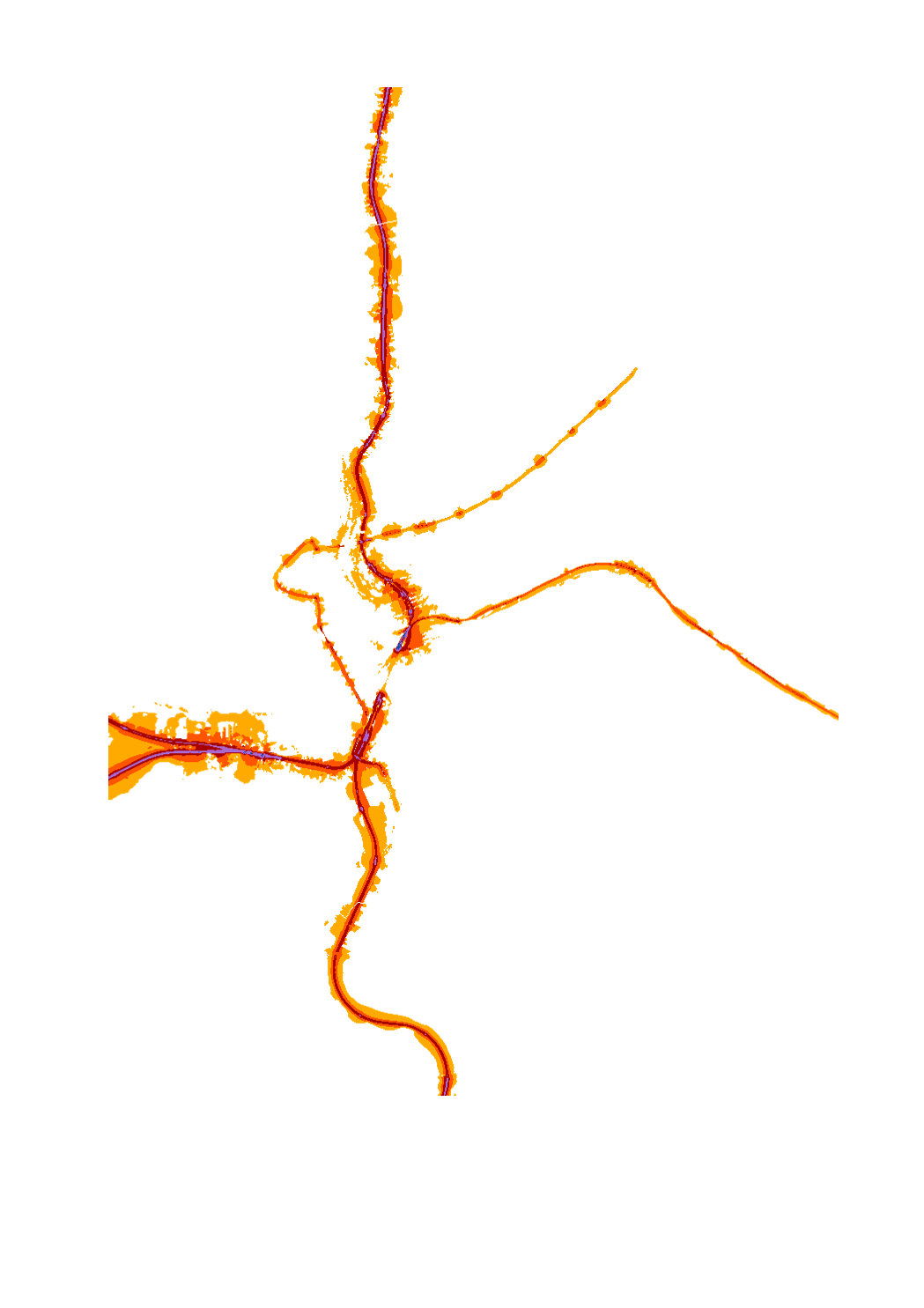
In accordance with European legislation, the Environment Agency has updated the strategic noise maps for the fourth cycle of Directive 2002/49/EC of the European Parliament and of the Council of 25 June 2002 relating to the assessment and management of environmental noise. These maps refer to the year 2021 and indicate, with the help of a standardised colour scale using the Lden indicator, the exposure to ambient noise in decibels of the major rail routes with more than 30,000 passages per year located within the territory of the Grand Duchy of Luxembourg.
-

Noise map of the major railways of more than 30'000 trains per year located on the territory of the Grand-duchy of Luxemburg and inside of agglomerations consisting of Luxemburg city, Bertrange, Hesperange, Walferdange, and Steinsel.. This map is representative for the year 2011 and is using the noise index LNGT. This noise map has been elaborated in the context of the DIRECTIVE 2002/49/EC OF THE EUROPEAN PARLIAMENT AND OF THE COUNCIL of 25 June 2002 relating to the assessment and management of environmental noise, transposed into national law by the loi du 2 août 2006 modifiant la loi modifiée du 21 juin 1976 relative à la lutte contre le bruit and the règlement grand-ducal du 2 août 2006 portant application de la directive 2002/49/CE relative à l'évaluation et à la gestion du bruit dans l'environnement. LNGT = 90 -> LNGT 85 - 90 dB(A) LNGT = 85 -> LNGT 80 - 85 dB(A) LNGT = 80 -> LNGT 75 - 80 dB(A) LNGT = 75 -> LNGT 70 - 75 dB(A) LNGT = 70 -> LNGT 65 - 70 dB(A) LNGT = 65 -> LNGT 60 - 65 dB(A) LNGT = 60 -> LNGT 55 - 60 dB(A) LNGT = 55 -> LNGT 50 - 55 dB(A) LNGT = 50 -> LNGT 45 - 50 dB(A)
-

Noise map of the major railways of more than 30'000 trains per year located on the territory of the Grand-duchy of Luxemburg and inside of agglomerations. This map is representative for the year 2016 and is using the noise index LNGT. This noise map has been elaborated in the context of the DIRECTIVE 2002/49/EC OF THE EUROPEAN PARLIAMENT AND OF THE COUNCIL of 25 June 2002 relating to the assessment and management of environmental noise, transposed into national law by the loi du 2 août 2006 modifiant la loi modifiée du 21 juin 1976 relative à la lutte contre le bruit and the règlement grand-ducal du 2 août 2006 portant application de la directive 2002/49/CE relative à l'évaluation et à la gestion du bruit dans l'environnement.
-

Noise map of the major railways of more than 30'000 trains per year located on the territory of the Grand-duchy of Luxemburg and inside of agglomerations. This map is representative for the year 2016 and is using the noise index LDEN. This noise map has been elaborated in the context of the DIRECTIVE 2002/49/EC OF THE EUROPEAN PARLIAMENT AND OF THE COUNCIL of 25 June 2002 relating to the assessment and management of environmental noise, transposed into national law by the loi du 2 août 2006 modifiant la loi modifiée du 21 juin 1976 relative à la lutte contre le bruit and the règlement grand-ducal du 2 août 2006 portant application de la directive 2002/49/CE relative à l'évaluation et à la gestion du bruit dans l'environnement.
-

In order to apply noise hotspot prioritisation factors objectively and systematically, a new index is introduced. The Comparative Noise Exposure Unit (UCEden) is an index based on the Lden noise index and is evaluated on the basis of strategic noise mapping. The exposure of a site is characterized according to the number of people disturbed and the Lden level to which these people are exposed. For this purpose, the UCE is defined according to the formula indicated in the legend where the UCEden is without unit, and N corresponds to the number of dwellings on the site, Pi corresponds to the number of persons domiciled at dwelling i, and Li is equal to the noise level Lden at the most exposed façade of dwelling i. Although the Li level is expressed in decibel (dB), the UCEden is actually an indicator without dimension, combining the exposed people and the exposure level of the dwelling they occupy. For more information, please access the elaborated noise action plans at www.emwelt.lu.
-

Noise map of the major railways of more than 30'000 trains per year located on the territory of the Grand-duchy of Luxemburg and inside of agglomerations consisting of Luxemburg city, Bertrange, Hesperange, Walferdange and Steinsel.. This map is representative for the year 2011 and is using the noise index LDEN. This noise map has been elaborated in the context of the DIRECTIVE 2002/49/EC OF THE EUROPEAN PARLIAMENT AND OF THE COUNCIL of 25 June 2002 relating to the assessment and management of environmental noise, transposed into national law by the loi du 2 août 2006 modifiant la loi modifiée du 21 juin 1976 relative à la lutte contre le bruit and the règlement grand-ducal du 2 août 2006 portant application de la directive 2002/49/CE relative à l'évaluation et à la gestion du bruit dans l'environnement. LNGT = 90 -> LNGT 85 - 90 dB(A) LNGT = 85 -> LNGT 80 - 85 dB(A) LNGT = 80 -> LNGT 75 - 80 dB(A) LNGT = 75 -> LNGT 70 - 75 dB(A) LNGT = 70 -> LNGT 65 - 70 dB(A) LNGT = 65 -> LNGT 60 - 65 dB(A) LNGT = 60 -> LNGT 55 - 60 dB(A) LNGT = 55 -> LNGT 50 - 55 dB(A) LNGT = 50 -> LNGT 45 - 50 dB(A)